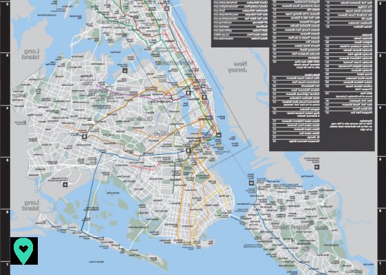
Map of New York to print: the city map
First of all, you can download the New York City official map by clicking here. You can even print it from home! I strongly recommend it, because it is very well done. In fact, you will find a list of the main attractions and their location on the map.
The main tourist attractions are in Manhattan and Brooklyn, which are arguably the liveliest areas of the city. That said, you will obviously find something to do in Queens, Bronx or Staten Island.
Here's a screenshot of part of this shot, where you can easily find your way around using the clues on the sides of the map.
Note that rather than printing them, you can order these cards for free (you will just have to pay the postage) from the official NYC GO website.
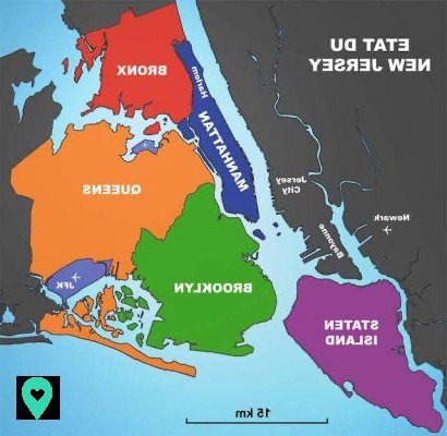
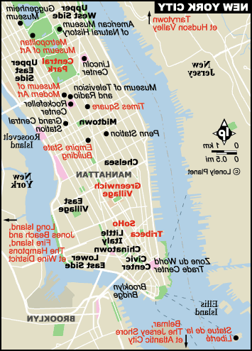
New York neighborhood map
New York is divided into five quarters : Manhattan, Brooklyn, the Bronx, Queens and Staten Island. Each borough you have many surprises in store and offers you to dive into a very special atmosphere :
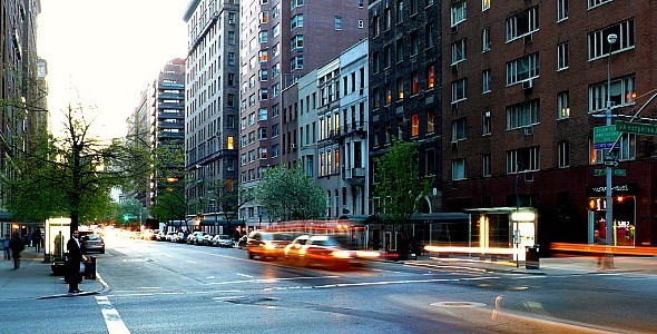
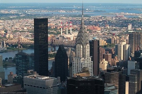
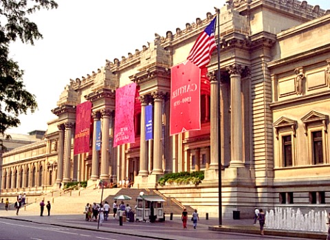
- Manhattan : New York's most famous neighborhood, Manhattan is made up of several neighborhoods. In Manhattan, you can discover the main tourist attractions of the city and go shopping on Fifth Avenue in particular.
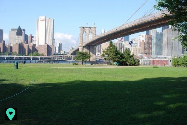
- Brooklyn : if in the past it was infamous, this district is now very famous and appreciated by tourists. Located not far from Manhattan, Brooklyn is worth a stop! You can visit the famous Brooklyn Bridge or the botanical garden, an ideal place to rest and recharge your batteries away from the hustle and bustle.
- The Bronx : if the Bronx had a bad reputation, today its image has changed. It is pleasant to walk there. You can visit the botanical garden as well as the Italian quarter of the city. Don't hesitate to go and explore the Arthur Avenue retail Market. you can find good Italian things there.
- Queens : in this area, you can enjoy the beach, stroll through Flushing Meadows Corona Park and discover interesting museums like MoMa PS1.
- Staten Island : this district is famous for its green spaces. During your visit, plan to stop at Clove Lakes Park and the Island's Botanical Garden. It's very nice.
Here is a map locating the five districts of New York:
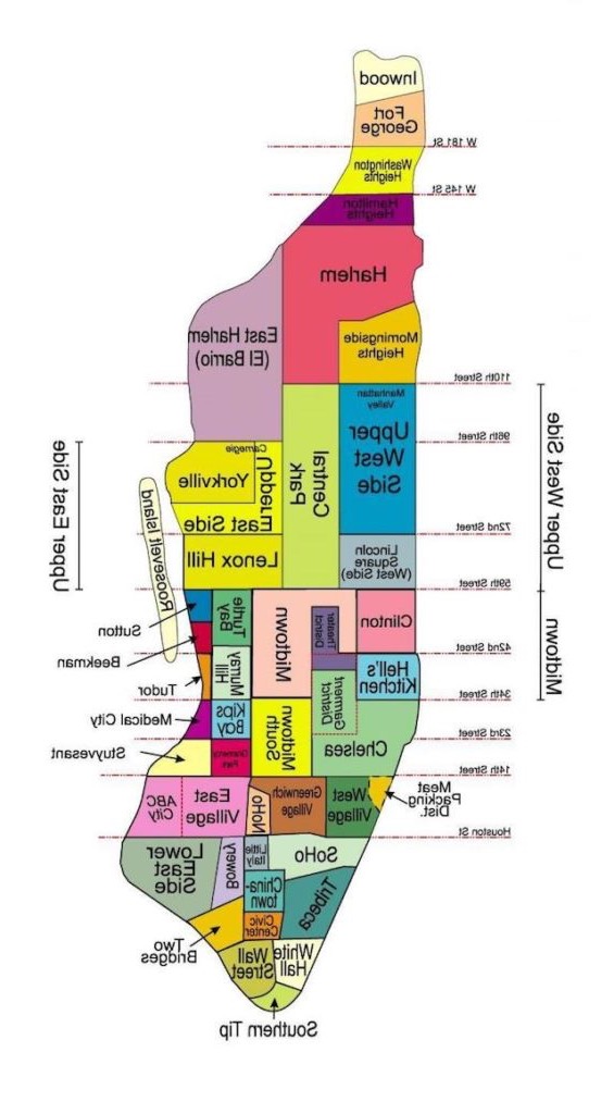
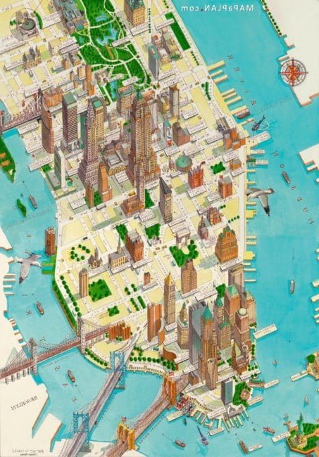
Manhattan plan
Manhattan is made up of several neighborhoods. To help you get your bearings, here is a map of Manhattan:
New York public transport map to print
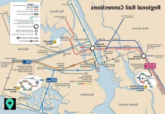
Airport transport plan
The first plan you are looking for in New York transport is undoubtedly the one connecting the various airports of the city to downtown Manhattan or other neighborhoods.
Also, don't worry: whether you arrive at JFK, LaGuardia or Newark Liberty, you will easily get to downtown.
Here is a plan highlighting your different possibilities, includingAirtrain and the MTA trains. You can download and print the high definition version by clicking here.
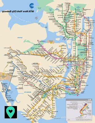
New York subway map to print
Then you will probably have to take the New York subway. The latter serves the city very well and is an economical option for getting around the Big Apple. Indeed, with 24 lines and 422 stations, you should be able to move around easily!
Here is therefore a map of the metro network to print (download the high definition version by clicking here). That said, don't panic: you can easily find some at paper format (and free) at all stations in the city.
In addition, if you live or want to travel to the vicinity of New York, there is also a network of commuter trains. The latter notably covers New Jersey, Long Island as well as the Bronx, Queens and Brooklyn.
The network is made up of the following 4 networks: New Jersey Transit (NJ Transit), Porth Authority Trans-Hudson (PATH), Long Island Rail Road (LIRR) and Metro North Railroad (MNR).
These 4 trains hold 29 lines and 423 stations. You can access the PDF map of the regional train network by clicking here.
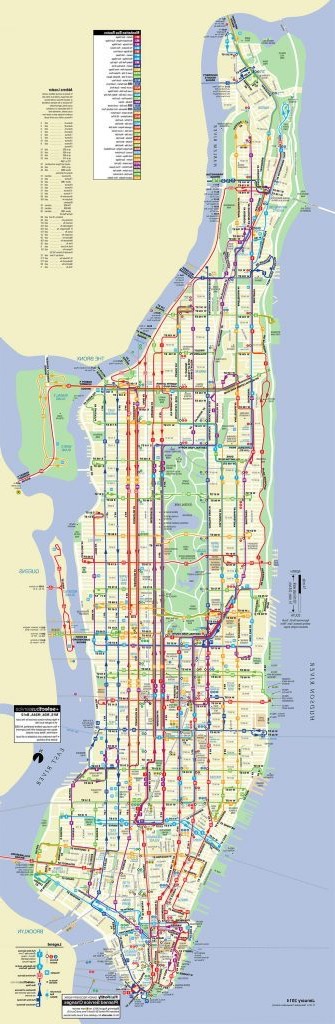
New York bus map to print
Finally, it is also possible to travel by bus in Manhattan. Slower and depending a lot on traffic, it is however pleasant to move around while admiring the city. If you have time, this is a good option to help you navigate your way and discover new places.
Also, you can find the Manhattan bus map in PDF format by clicking here.
If you count move around Brooklyn, there is also a bus network serving this borough very well. You will find it in PDF format to print it here.
Map of iconic places in New York
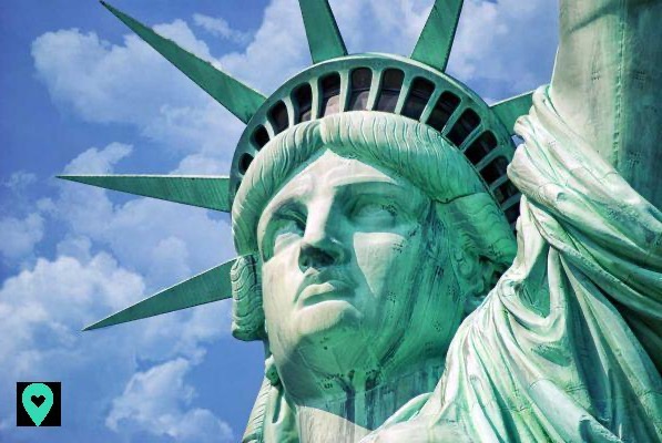
Los of your stay in New York, you will visit a multitude of emblematic places. Monuments, places of interest ... The Big Apple is full of sites to discover: Empire State Building, Statue of Liberty, Times Square, Brooklyn Bridge, Central Park and many more! To help you locate them, here is a map to print.
Map of New York landmarks
Map of places of interest in New York
And here ! Thanks to these plans, you should be able to navigate and navigate the Big Apple more easily. Do not hesitate to print them and soak up them, just to pass for a local before even arriving in New York!
And then, while you are in your preparations, don't forget your Pass! Check out my article on the New York City Pass and New York Pass, and take your pick. This will save you time and money. Have a nice trip !